Happy New Year
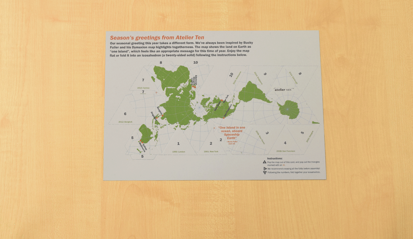
One island in one ocean
Bucky Fuller’s Dymaxion map highlights togetherness, showing the land on Earth as “one island”.
Why we love Dymaxion maps
In the aftermath of World War II, R. Buckminster Fuller set about developing a map projection to promote ideals of unity and togetherness.
The Dymaxion map shows Earth’s surface as one island without splitting any continents. It is also one of the most accurate map projections, with less distortion than most 2D representations that we are used to. Seeing our planet in this way, we are reminded that we are “one island in one ocean” together aboard Spaceship Earth.